
| "Palestine, Israel & Other Tragedies" |

"Palestine, Israel & Other Tragedies"
Part 1 of 2 Parts (Slides 1-67)
Shown below is a PowerPoint presentation which I made on January 3, 2012, to a group associated with the University of Tennessee in Knoxville, Tennessee. The slides & commentary are based on a trip made in June 2011. The presentation includes a few photos from East Tennessee to show some similarities & to make a few points about the universality of the struggle for peace & justice. The slides are relatively small. But, using some browsers (e.g. Netscape Navigator & Mozilla Firefox), right clicking enlarges any image, & a subsequent left click causes the image to fill your computer screen. I hope & assume that other browsers (e.g. Internet Explorer & Google Chrome) have the same feature, but I've never learned how to make it work.
Underlined words & phrases are hot links. Clicking them takes you to other parts of my website, to Wikipedia articles & to other relevant information.
For a record of all places visited in June 2011, see Part I (West Bank) & Part II (Israel). Also see updated web pages for Palestine before 1949 | Palestine after 1948 | Israel after 1948 | Israel (Arab monuments only) | Jerusalem (West & East) | Yad Vashem Holocaust Memorial | Village of Deir Yassin | Olive Trees & Branches | Peace Poles | Rachel Corrie [1979-2003] | vocabulary of the Israel/Palistinian conflict | Films about Palestine | "My trip to Palestine & Israel" by Sam Neff | "Missing a Chance for Peace" by Tony Bing | "The Palestinian Plight" by Jim Matlack.

Slide 1
The title of my talk is "Palestine, Israel & Other Tragedies." The title reveals what I think about the situation in both Palestine and Israel today. As for "other tragedies," I shall also refer to to the Trail of Tears here in East Tennessee in the 1830's, the Holocaust of the Nazi era, the atomic bombing of Hiroshima in 1945, the Deir Yassin massacre in 1848, and the church shooting here in Knoxville in 2008.

Slide 2
This is the only bullet slide I'm going to show. It says what I hope you'll learn from this talk. I am not going to go over these points again. I hope that they will emerge from the pictures that I am about to show you. /// Many of my slides show the Israeli wall, settlements, and "bypass" highways. These are what the Israeli government calls "facts on the ground" and what everyone else sees as a major impediment to the achievement of justice for the Palestinians. /// The fifth bullet refers to monuments & symbols. I have a special interest in monuments & believe that they help explain history. /// The last bullet on this slide asks, "Am I biased?," & the answer is "Yes." I went to Palestine and Israel with a group led by Prof. Tony Bing, a former chair of the Peace & Justice Studies Association (PJSA). He arranged meetings for us both with Palestinians and with Israelis who oppose the Israeli occupation of the West Bank. Visitors who go to the "Holy Land" to see religious sites or to conduct business in the very modern State of Israel have a much different experience.

Slide 3
It's easy get to Palestine and Israel. I flew non-stop from Newark (EWR) to Ben Gurion Airport (TLV) -- but I took this picture, as you can see, as my plane flew over Iceland on the way back to Newark. Ben Gurion is the only international aiport in Israel or Palestine, but the Israeli government won't allow Arab residents of the West Bank to use it. If you ever meet a Palestinian in this country, chances are that he or she had to travel all the way to Amman, Jordan, and use the airport there.

Slide 4
After landing in Ben Gurion, a few members of my group and I drove "directly" to Bethlehem in the West Bank. Bethlehem is a suburb of Jerusalem, and the van I was in used expressways headed for Jerusalem, and, as you can see, this meant going in and out of the West Bank and going around Jerusalem on the east side. Thus -- like anyone driving from the airport to the official capital of Israel -- we were stopped at many Israeli check points (upper image) and saw the ugly wall (lower two images) along much of our route. As you can see from the map scale, distances are short. Our journey took about two hours.

Slide 5
We spent four nights in Bethlehem -- two in a guest house and two in Palestinian homes. This map shows the route of an excursion to the southern part of the West Bank. By the way, the green portions of this map show parts of the West Bank which are under the full control (Area A) or under the partial control (Area B) of the Palestinian Authority (PA). The white portions -- including the Jordan River valley and many highways zig-zagging throughout the West Bank -- are under permanent Israeli control. Small black triangles show some of the many Israeli settlements, & red lines show the wall or fence (aka separation barrier, security barrier & apartheid wall).

Slide 6
Route from Bethlehem to Ramallah & Bil'in. Again, around the east side of Jerusalem. I was surprised how close the desert approaches Jerusalen from the East. We passed Bedouin encampments -- and an Israeli ordnance depot with hugh tanks stored outdoors under tarpaulins. One recently constructed highway traversing Wadi Al-Nar (the Valley of Fire) was illuminated with solar panels & labeled with USAID signs. I don't know the story of this highway. Someone said that it was constructed to help Palestinians travel between Bethlehem & Ramallah but is under Israeli control & therefore restricts Palestinians as much as ever. Ramallah is the seat of the Palestinian Authority (PA) and appears to be the busiest city in the West Bank. The short road west to Bil'in was narrow and rural.

Slide 7
I have to interupt my series of maps to show this one photo I took in Ramallah. We were there only half a day. A Palestinian-American in Knoxville insisted that I visit Jean Zaru, clerk of the Friends Meeting in Ramallah. That's her in the photo, along with the "Middle East Dialogue Quilt" in the front of the Friends meeting house. It was made in Boston but transported to Ramallah by my friend whose Christian family has lived in Knoxville since 1923. An olive tree, the quintesential symbol of peace, dominates the design of the quilt. Note the cream color of the unpainted wall. This is "Jerusalem stone," used for centuries in the Jerusalem area.

Slide 8
From Bil'in, we drove past Israeli settlements to Nablus, a fairly sizable Palestinian city, where we stayed in a commercial hotel. The top image is a martyr's monument in a small square in downtown Nablus. The next day we went to Mount Gerizim (home of the Samaritans) and the city of Jenin in what is probably the most fertile part of the West Bank (as evidenced by the traffic circle watermelon in the middle image). Leaving Jenin was hectic, owing to our driver's not knowing how to find the road to the Israeli check point at Jalameh (paid for by USAID in 2009) which closes at 5:00 pm. But we made it with minutes to spare, only to sit for an hour while half of us were pulled off the bus by a pretty young female officer and two armor vested male guards toting huge machine pistols for baggage inspection inside one of the check point buildings. From there to the Israeli city of Nazareth, we zipped through the Jezreel Valley, the flatest and most fertile part of Israel.

Slide 9
From Nazareth, we made side trips around the Sea of Galilee and to Al-Ghabisiyya (an Arab village depopulated in 1948 which I shall talk about later). The upper image shows the American tapestry in the Church of the Annunciation in Nazareth. The middle image shows a member of our group emerging from the Sea of Galilee. And the bottom image shows the only remaining structure in Al-Ghabisiyya.

Slide 10
We drove in one long day from Nazareth to East Jerusalem. I made the upper photo from our bus as we drove through Israel's port city of Haifa. The middle photo shows the fantastic garden at the Baha'i World Center. And the bottom image is an Israeli peace worker whom we met at a home in sandy Tel Aviv. Ein Hawd is a "stranded village" near Mount Carmel outside Haifa. "Stranded" means that it remained populated after the revolution of 1948 but was not recognized by the Israeli government for many years and therefore received no services like schools and a water supply.

Slide 11
The group spent two nights in East Jerusalem, visiting the walled Old City, modern West Jerusalem, and both Arab and Jewish parts of East Jerusalem. I'll talk about the Israeli settlement of Ma'ale Adumim later. I spent two extra days in Jerusalem, particularly in order to visit the Japanese peace bell (extra slide at right) & Yad Vashem, the world's largest Holocaust memorial and museum (about which I'll speak at length). Of course, the last thing I did in Israel was to drive the highway to Ben Gurion Airport and to see -- for the third time -- the check points & separation barriers which separate Jews from Palestinians.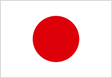


Slide 12
Here's that map again. This time, I'm identifying eight specific locations which we'll visit during the remainder of this talk. I'll show you these eight places in the order that they represent the history of the Palestine-Israel conflict: (1) Yad Vashem, the world's foremost Holocaust Museum, and Deir Yassin, the most nortorious massacre of the Israeli "War of Independence," are within sight of each other. (2) the depopulated Arab village of Al-Ghabisiyya. (3) Arab refugee camps in Bethlehem. (4) Jenin & The Freedom Theatre. (5) At-Tuwani in the far south. (6) Tent of Nations. (7) Bil'in. And, finally, I'll conclude with (8) Ma'ale Adiumim & a few other illegal Israeli settlements in the West Bank of today.

Slide 13
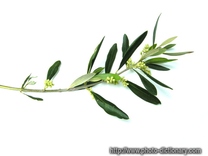
The first of our eight visits combines Yad Vashem and Deir Yassin. Yad Vashem represents the Holocaust, the seminal event in the creation of Israel and still the preoccupation of Jews everywhere. Within sight of Yad Vashem is Deir Yassin, the most nortorious monument to Israeli oppression of the Palestinians. /// The new logo of Yad Vashem is an olive branch emerging from barbed wire (far right).

Slide 14
Yad Vashem is a sprawling campus of museums, offices, and many memorials. The only thing quite like it which I've ever seen is Peace Memorial Park in Hiroshima (Japan), as depicted in the image at the far right.

Slide 15
One of Yad Vashem's many memorials is this "Hall of Names" with many photos of Holocaust victims. It is intended both to personalize and to represent the enormity of the Holocaust (also called the Shoah). On my website, I try to identify Holocaust museums everywhere. Of course I've probably missed some, but my site currently shows 64 such museums in 19 different countries. Twenty-nine (45%) of the museums are at historic sites in Europe, and nineteen (30 percent) are in the United States. Probably every Holocaust museum has a wall like this with the photos of actual victims.

Slide 16
Yad Vashem's "Hall of Remembrance" is the national shrine of Israel where every visiting head of state or govenment goes to pay respects and to lay a wreath of flowers (like the cenotaph in Hiroshima or the Arc de Triomphe in Paris). Note the eternal flame and the names of Nazi death camps on the floor. Auschwitz is at the far right of the photograph.

Slide 17
There are lots of eternal flames all over the world, e.g. John F. Kennedy's grave in Arlington, Virginia. Since the Holocaust -- and Nakba -- remind me of the ethnic clensing of East Tennessee, including the Trail of Tears, I include this photo of the Eternal Flame of the Cherokee Nation in Red Clay Historic Park not far from here.

Slide 18
A Polish railroad car used to transport Jewish victims to death camps during World War II. I have attempted to identify all European rail cars now on exhibit in Holocaust museums, and my website currently shows a total of eighteen, of which ten are in the United States, including three in Florida and one in Tennessee.

Slide 19
German railroad car used during World War II. Now a Holocaust Memorial at Whitwell Middle School in Whitwell, Tennessee. It contains 6,000,000 paper clips collected by students to demonstrate the enormity of 6,000,000 victims of the Holocaust.

Slide 20
The Yad Vashem sculpture at right is "The Warsaw Ghetto Uprising" by Polish-American sculptor Nathan Rapoport [1911-1987]. The statue at left is in Knoxville, Tennessee. It depicts the principal Cherokee chief during the signing of the Treaty of Holston in 1791. His signing deprived the Cherokee of their native lands & drove them out of Tennessee altogether by 1838. I think it's sobering to reflect that I and the other black & white residents of today's Tennessee are the "beneficiaries" of ethnic clensing, just as the Nazis were in Europe and the Israelis are in Palestine today.

Slide 21
Monument by Nandor Glid [1924-1997] at Yad Vashem. Israeli soldiers in foreground. The sculpture depicts contorted victims in a way very reminiscent of Picasso's "Guernica" about the Spanish Civil War (the original of which is in Madrid, with a tapistry hanging outside the Security Council at the UN in New York City.)

Slide 22
Picture I took in August 2010 at Dachau Concentration Camp near Munich in Germany. The identical monument by Nandor Glid is the most significant memorial at Dachau. It's where visitors concentrate in order to commemorate the camp's victims. I love to be able to connect similar monuments in different countries.

Slide 23
Airview of the Yad Vashem campus. The linear feature is a long skylight over the new Holocaust History Museum designed by Israeli-Canadian architect Moshe Safdie. The museum is mainly in undergroud galleries to the right and left of the long corridor under the skylight. At each end, the corridor juts out over an adjacent valley.

Slide 24
Moshe Safdie also designed the new building of the US Institute of Peace (USIP) on Independence Avenue in Washington, DC. Designed to look like a dove from the air, its glass roof juts out over the walls of the building, something like Safdie's museum at Yad Vashem. I took this photograph in November 2011.

Slide 25
This is a file photo of the museum's skylight and its north end which flares and gives a spectacular view Jerusalem's western suburbs. The Yad Vashem logo mimics the linear design of Safdie's museum, including the flare at its North end.

Slide 26
I took this photo from a little lower down. Foot traffic though Safdie's museum is one-way from South to North. This photo shows two visitors exiting from the museum.
Slide 27
This the end of the museum's central corridor, as seen from inside.

Slide 28
At the very end, visitors stand behind a glass barrier and receive a unobstructed view of the Jerusalem Forest & of residential suburbs beyond. I've read that this is the whole idea of the museum's design -- that visitors who have just seen how Jews suffered under the Holocust suddenly emerge into daylight & behold a beautiful scene containing unmistakable evidence of Jewish rebirth & of Israel's ability to create a paradise in the Biblical Promised Land. The Yad Vashem logo incorporates the same idea -- emergence from tragedy to beauty & peace.

Slide 29
Another view looking North from Yad Vashem. This steel sculpture (of an anguished Holocaust victim) is on the terrace of the complex of buildings which houses Yad Vashem's administrative offices, research center & School of Holocaust Studies. Directly opposite Yad Vashem is the Palestinian village of Deir Yassin which was depopulated by Jewish armies during the war for Israeli independence in 1948.

Slide 30
Another modern view of Deir Yassin. Most of these buildings were Arab homes in 1948. Today, they are part of an Israeli mental hospital which is surrounded by a fence & closed to the public. Israel memorializes the Holocaust but ignores tragedies perpetrated during in 1948 -- and ignores the tragedy of its 1967 occupation of Palestine (which is on-going after 44 years).

Slide 31
This is Deir Yassin just after the massacre on April 9, 1948. After their parents were killed, 55 children were taken to the Old City & abandoned. Their story is summarized in the recent film Miral (which happens to include a short appearance by Juliano Mer-Khamis).
Slide 32
And this Arab cemetery is all that's left of the old village. The Israeli govenment is said not to allow Muslims to maintain the cemetery, so it is slowly crumbling away.

Slide 33
These upturned olive tree roots are the only true monument to the massacre which took place at Deir Yassin on April 9, 1948. Tragicly, it's thousands of miles away on Seneca Lake in Upstate New York (USA). Note the final lines of the plaque which say that "Deir Yassin...lies...only 1,400 m to the north of Yad Vashem, the most famous af all the Holocaust memorials. The irony is breathtaking."
V
I
D
E
O2006? - "Deir Yassin Remembered." "A 33-minute on-line documentary video produced by Deir Yassim Remembered (DYR), Geneva, New York (USA). It features Deir Yassin Remembered Executive Director Daniel A. McGowan, massacre survivor Zeinab Akel, Palestinian activists Raneen Jeries & Fahmi Nashashibi, Dar Al Tifl Al Arabi School & Orphanage Director Mahira Dajani, Zochrot founder Eitan Bronstein, International Solidarity Movement activist Neta Golan, founder & coorinator of Israeli Committee Against House Demolitions Jeff Halper & others."

Slide 34
In 1948, Jewish armies depopulated more than 400 Arab villages (the black dots on the right hand map). This consolidated the northern part of Israel & drove a wedge into Palestine from Tel Aviv to Jerusalem. Israel thus became independent on May 14, 1948, with far more territory that the naissent United Nations had intended just the year before. We've already visited Deir Yassin near Jerusalem. We'll now go to Al-Ghabisiyya, another depopulated village which is close to the Lebanese border in the far North of Israel.

Slide 35
Our second visit is to Al-Ghabisiyya, an Arab village close to the Lebanese border. We did not visit the border. Nor did we visit Beit Lohamei Hagetaot / Ghetto Fighters' House Museum on the Coastal Highway (#4) between Acre (Akko) & Nahariya. Founded in 1949 by members of Kibbutz Lohamei Hagetaot, a community of Holocaust survivors, among them fighters of the ghetto undergrounds & partisan units, Beit Lohamei Hagetaot is "the world�s first museum commemorating the Holocaust & Jewish heroism" (with the possible exception of Auschwitz which was opened to the public in 1947).

Slide 36
Our guide was born in Al-Ghabisiyya & was driven out in 1948 when Israeli armies, recalling Deir Yassin, told villagers to leave temporarily for their own safety. They have never been permitted to return, although many, like our guide, still live nearby. /// The extra slide at the right is part of an 1870 map showing Al-Ghabisiyya & other Palestinian villages.

Slide 37
These few stones are all that remain of Al-Ghabisiyya's many Arab houses. Most stones have been removed for use elsewhere, and the land has been made part of an Israeli reforestation project. Cacti were formerly cultivated in villages such as this to mark property lines and to separate animals. Their roots survive, and the sites of destroyed Arab villages can sometimes be determined from where the cacti grow today. /// Such cacti symbolize Sumud (Arabic for "steadfastness" or "steadfast perseverance") which in an "ideological theme & political strategy that first emerged among the Palestinian people through the experience of the dialectic of oppression & resistance in the wake of the 1967 war..."

Slide 38
The village mosque was the only building not destroyed by the Israelis. Note (1) the blocked door leading to the mosque's courtyard, (2) white portions of the fence which once surround the the mosque, & (3) two trees which have grown up inside the mosque.
Slide 39
David Reese (seen on the wall at left), the editor of Montana Living Magazine, and I climbed into the ruin. This is a panorama of six photographs showing the interior of the mosque today. Al-Ghabisiyya descendants have asked many times for permission to maintain the mosque but have always been refused by Israeli authorities. Note the same two trees seen in the previous slide.

Slide 40
Our third visit is to Bethlehem and its two reugee camps. About 700,000 Palestinians were made homeless in 1948 and have never returned home. Of course the youngest of these is now 64 years old. Most of them and their descendants still live in refugee camps mained by a unique agency of the United Nations, the "UN Relief & Works Agency for Palestine Refugees in the Near East" (UNRWA). There are 10 camps in Jordan, 12 in Lebanon, 13 in Syria, 19 in the West Bank, and 8 in Gaza. Click here for a very nice map showing all of the camps.

Slide 41
This is the western edge of Bethlehem. Note the modern Israeli-only highway & adjacent security barrier which skirt the city and the Israeli check point in the distane. I did not take this photo.

Slide 42
This looks in the exact opposite direction. The last photo was taken from the hill in the distance. I took this photo from a moving bus. The flag denotes the nationality of the check point in the last photo.
Slide 43
Also taken from a moving bus. Red signs like this one warn Israelis not to enter Area A, such as around Bethlehem, which is under the control of the Palestinian Authority (PA).

Slide 44
This is a file photo of a wall proclaiming "Love and Peace" which used to exist on the tourist & pilgrim route between Bethlehem & Jerusalem.
Slide 45
This is what the wall looks like today: The Israeli security barrier with a big steel door to permit passage when the army is relaxed, a fortified watch tower & a "Peace Be With You" banner hung by the Israeli Ministry of Tourism (partially covered with barbed wire).

Slide 46
This is what Palestinians have to do to cross between Bethlehem & Jerusalem (where many work). They have to take Palestinian cars or buses to the Bethlehem side of the wall & transfer to Israeli transportation on the Jerusalem side.

Slide 47
This slide show is NOT about the many holy sites in Palestine & Israel. Here's one exception -- the spot condidered to the birthplace of the "Prince of Peace" in a grotto under the Church of the Nativity in Bethlehem. I took this picture, and it turned out pretty good despite the artificial light. /// The extra slide at the right shows the nearby Shepherds' Field in the Bethlehem suburb of Beit Sahour. In this chapel (designed by Antonio Barluzzi [1884-1960] in 1954) & grotto, "PAX" & "Peace on Earth, Good Well to Men" are inscribed in multiple places, mostly in Latin.

Slide 49
"Merry Christmas World from Bethlehem Ghetto." Graffiti on the Israeli security wall in Bethlehem. The wall runs right down some of the city streets.
Slide 48
"To exist is to Resist." More graffiti on the Palestinian side of the Israeli security wall. Palestinians call it the apartheid wall.

Slide 50
Behind a home in the D'helsheh Refugee Camp. Six panels with text book maps of Palestine from 1946 (when Jews owned scattered parts of Palestine) to the near future (when the map maker fears Palestinians will control just a few dots of territory). The stencil at the far left reproduces a refugee ID card issued by UNRWA.

Slide 51
A monument with the text of UN General Assembly Resolution 194 in English & Arabic. This gives Palestinians the right to return to the homes they occupied before trhe Arab-Israel War of 1948. Of course Israel has never permitted any Palstinian to exercise this right.

Slide 52
Graffiti in the D'helsheh Refugee Camp. This slide shows David Reese taking a photo of a famous cartoon by English street artist "Bansky." It satirically reverses the role of the all powerful Israeli army guards & powerless Palestinians, here represented by an innocent child. The original of this famous wall painting is not far away near the Israeli security barrier.

Slide 53
This slide shows a key & keyhole-shaped arch over a street in the Aida Refugee Camp. Many Palestinians took their keys with them when they left home in 1948, expecting to return soon. So the key has become a symbol of their right to return, however hopeless this now appears to be. The camp's UNRWA office is at the left, the Israeli security barrier is just out of sight to the right, & an Israeli control tower can be seen in the background.

Slide 54
This shows a mural in the D'helsheh Refugee Camp. The face is a well-known Palestinian martyr -- probably a suicide bomber or someone killed by the Israelis. Note some of the symbols of normalcy & of the refugees' right to return home -- a mosque, a house secured by a stout door, a flower, a Koran & a key. I can't read Arabic so don't know what is written in red.

Slide 55
Our fourth visit is to the City of Jenin in the far north of the West Bank. At the side of the road just South of Jenin is a monument (extra slide at right) which appears to represent a large key, a keyhole, four flying birds, a house with a closed door & maybe some flames. Something to do with the right of return? I took this picture from a moving bus & have no other information. If anyone knows more, please contact me at geovisual & comcast.net. Thank you.

Slide 56
This is a file photo of the Jenin Refugee Camp in 2002 soon after the "Battle of Jenin" when Israeli tanks, phanes & bulldozers leveled a large part of the camp.
Slide 57
Jenin Refugee Camp when we visited in 2011. Restored with financial assistance from other Arab countries. Note incomplete building at left. This is typical in less developed countries where construction loans are difficult if not impossible to obtain and homeowners invest their savings a little at a time in bricks & morter. The center of the camp has a monument (extra slide at right) made from the bodies of vehicles destroyed during the battle. Note panel which reads "AMBULANCE" in Arabic & English. The horse is a project of the Goethe Institut in Germany.

Slide 58
An entrace to The Freedom Theatre at one edge of the Jenin Refugee Camp. The theatre was founded in 2006 by Juliano Mer-Khamis [1958-2011], an Israeli actor, director, filmmaker & political activist of Jewish & Christian Arab parentage, in order to "enable the young generation in the area to develop new & important skills which will allow them to build a better future for themselves & for their society."

Slide 59
We saw six actors reherse a play about oppression. The oppressor (arrogantly smoking a cigarette at the far right of this scene) subjected his five victims to a series of humiliations. No words were spoken, and the drama could have as easily represented the Holocaust as the Israeli occuation of Palestine. The recorded music & lighting were spectacular. I was very moved. David Reese returned to shoot a second rehersal from a differnt angle so he could edit a video of the entire performance.

Slide 60
Rawand Arqawi just outside the Freedom Theatre in Jenin. She received us when we arrived & told us about the theatre & about the assassination of its director, Juliano Mer-Khamis [1958-2011] only two months before. As we were leaving, she took me into the street to show me where Juliano had been killed, & I took this photo. Had I pointed my camera a little to the left, the photo would have shown the actual place of the murder.
Slide 61
Posters of Juliano Mer-Khamis at the Freedom Theatre just after the murder.

Slide 62
A press photo of Juliano's car & blood. The assassin stalked & targeted him. His pregnant Finnish wife, their son Jay & a nanny were also in the car but unharmed. Rawand Arqawi told us that the killer's identity, nationality & motive are still unknown. A month after our visit, the Israeli army raided the Freedom Theatre for unknown reasons.

Slide 63
Juliano's coffin begins its journey from the Freedom Theatre to Haifa in Israel. Of course this & the other photos of this incident are from the international press (not from me).
Slide 64
Bearing Juliano's coffin through the streets of Jenin.

Slide 65
Crossing into Israel at the Jalameh check point. This is the same crossing we used between Jenin & Nazareth. Note the Israeli watch tower in the background of this image.
Slide 66
Juliano Mer-Khamis lying in state at the Almidan Theatre in Haifa. The Arabic script on his picture reads shaheed al-huriya ("Martyr for Freedom"). Seeing this photo in Newsweek Magazine was the first I knew about Juliano & his assassination.

Slide 67
The senseless assassination of Juliano Mer-Khamis forcefully reminded me of the equally senseless murder on July 27, 2008, of two friends at my church in Knoxville, Tennessee. This plaque is now installed on a wall of the church next to scars made by buckshot from the killer's shotgun. The portraits show the two victims -- Greg McKendry & Linda Kraeger. Greg's shooting gave some other men time to jump the killer. If they had not acted quickly, he could have used his 70 shotgun shells to kill many of the children who had been performing "Annie Jr.," as well as their parents & other spectators.

END OF PART I
Click here for the beginning of Part 2 (Slides 68-127).
Click here to return to the beginning of Part 1 (Slides 1-67).
|
Then page down & choose a link to one of more than 400 web pages. | Loading
|
